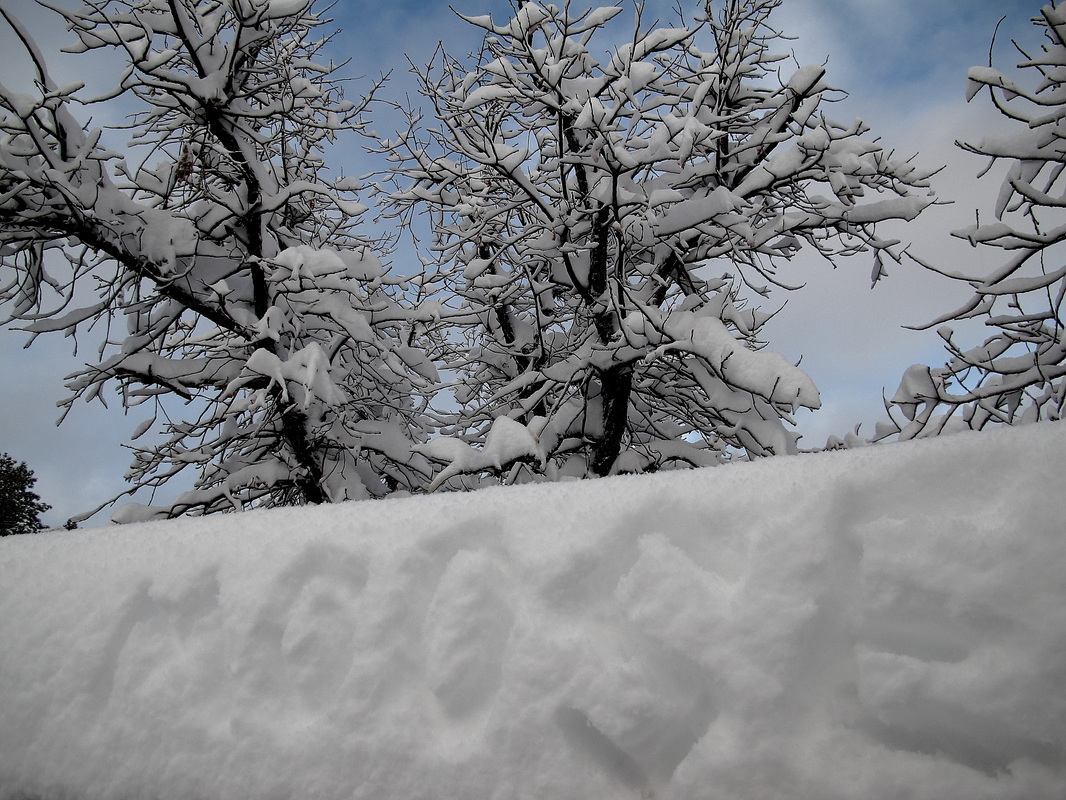
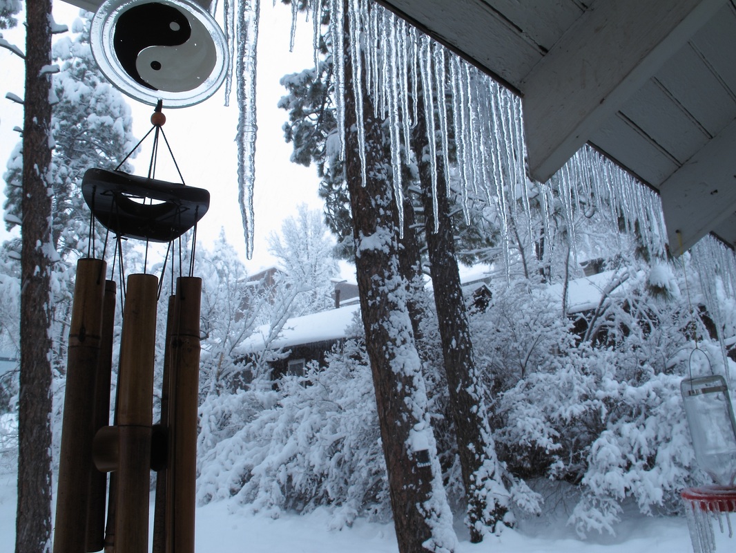
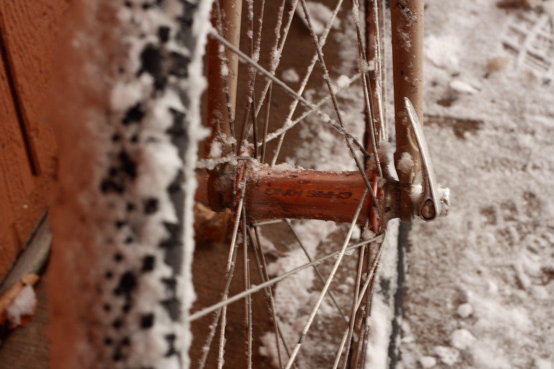
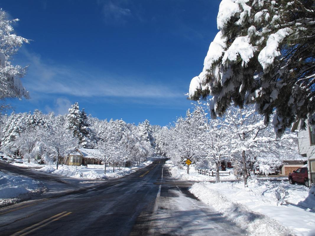
On Sunday, the storm had mostly cleared. Clear blue skies took its place. I shoveled my sidewalk and happily enjoyed the beauty of my neighborhood. 
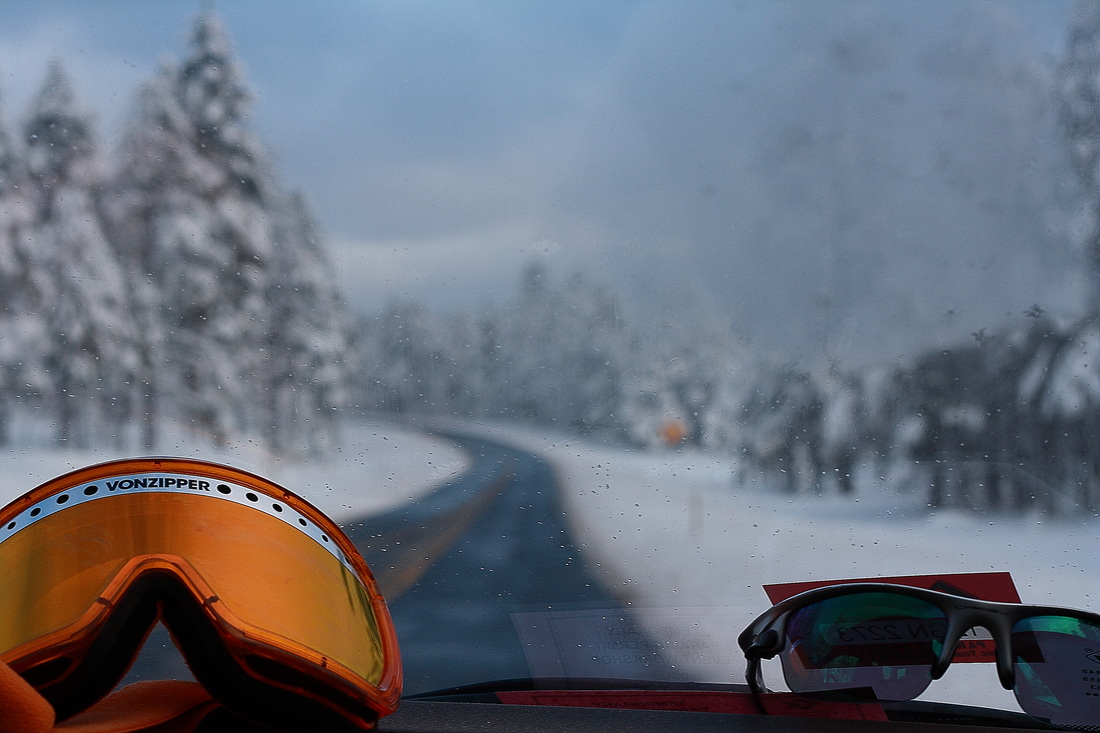
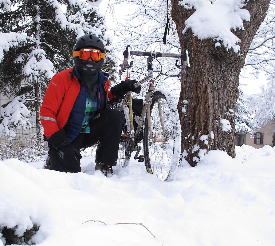
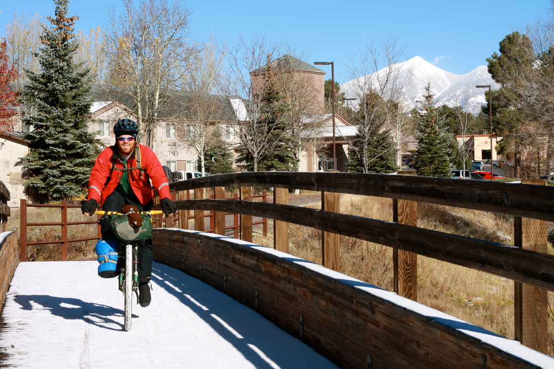
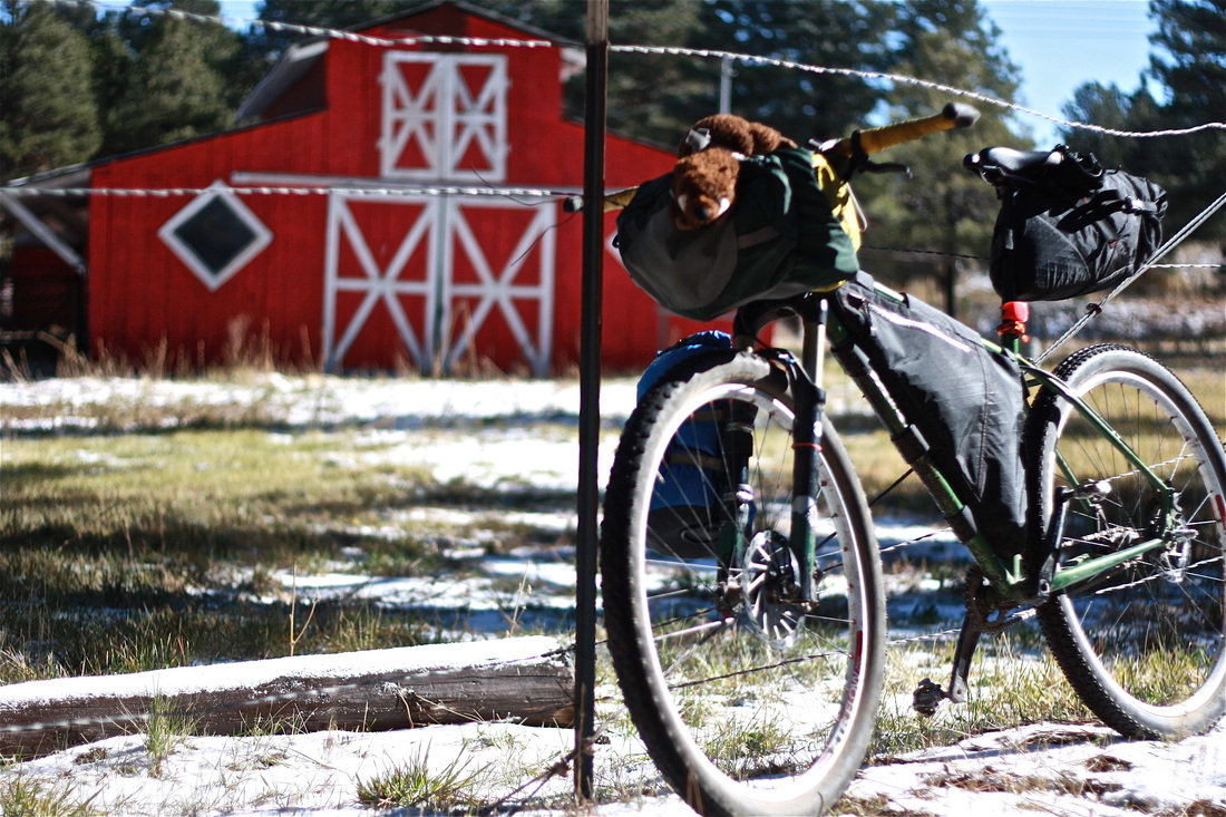
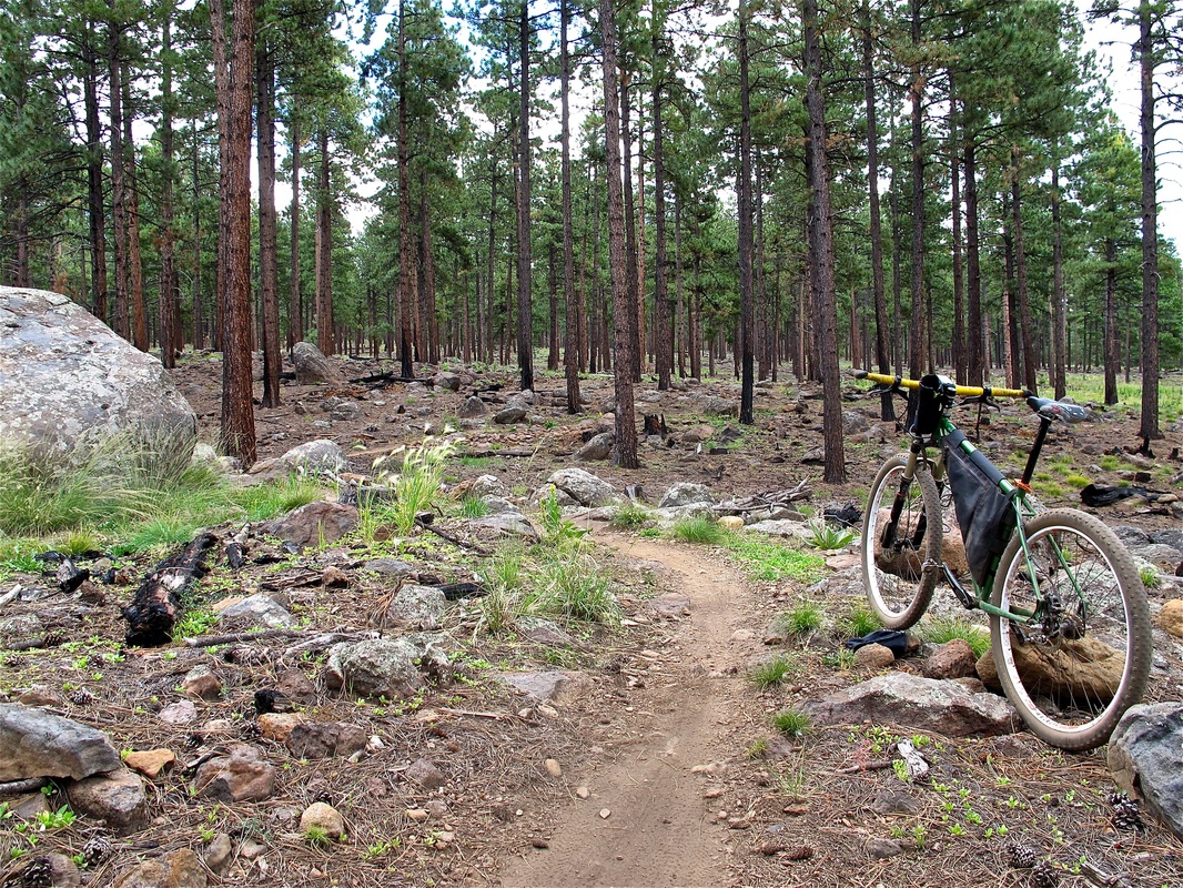
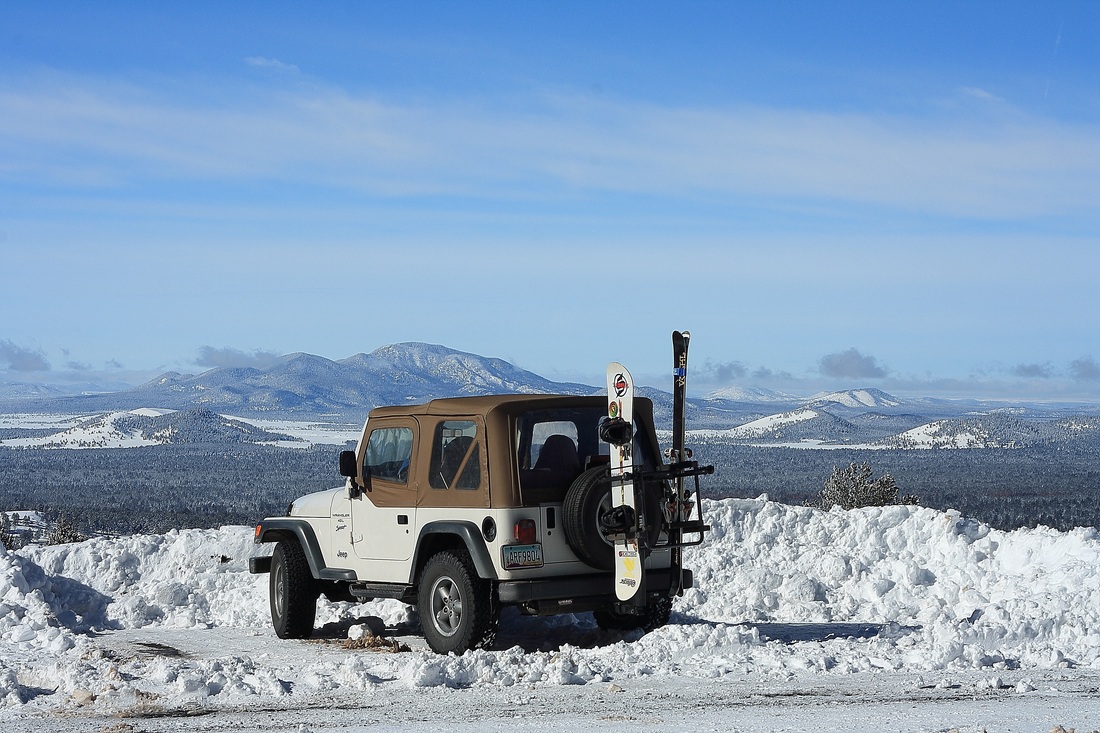
Felipe and I decided it was time for another adventure, so we headed up the mountain to see what we could see. Per usual after a snow, lots of skiers and snowboarders were snowshoeing up the mountain in order to ski back down. There were also a few idiots getting their 2-wheel drive cars stuck. 
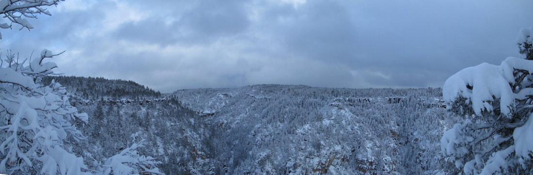
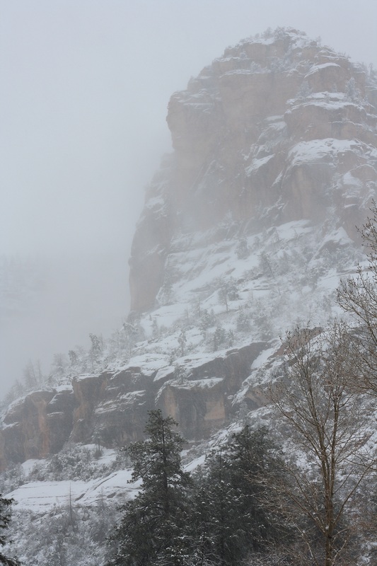
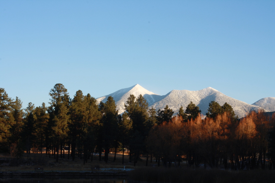
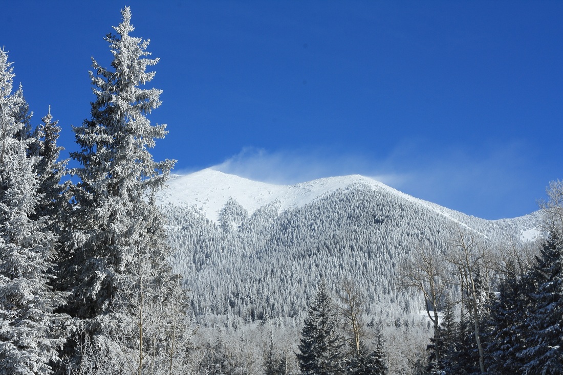
The mountain itself had turned old overnight, its once green hair turning a bright white. At the top, the wind was howling, sending snow flying to the south. 
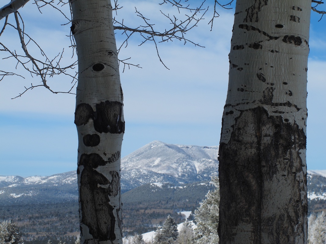
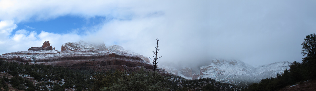
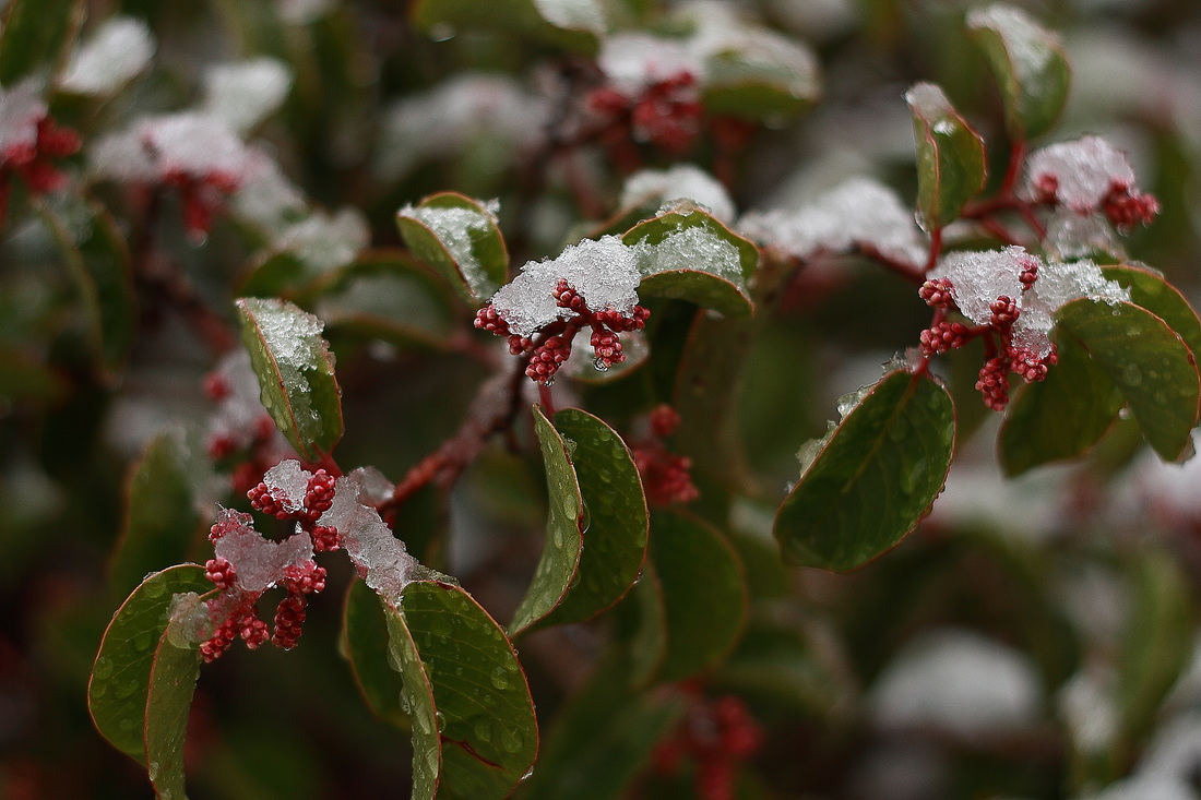
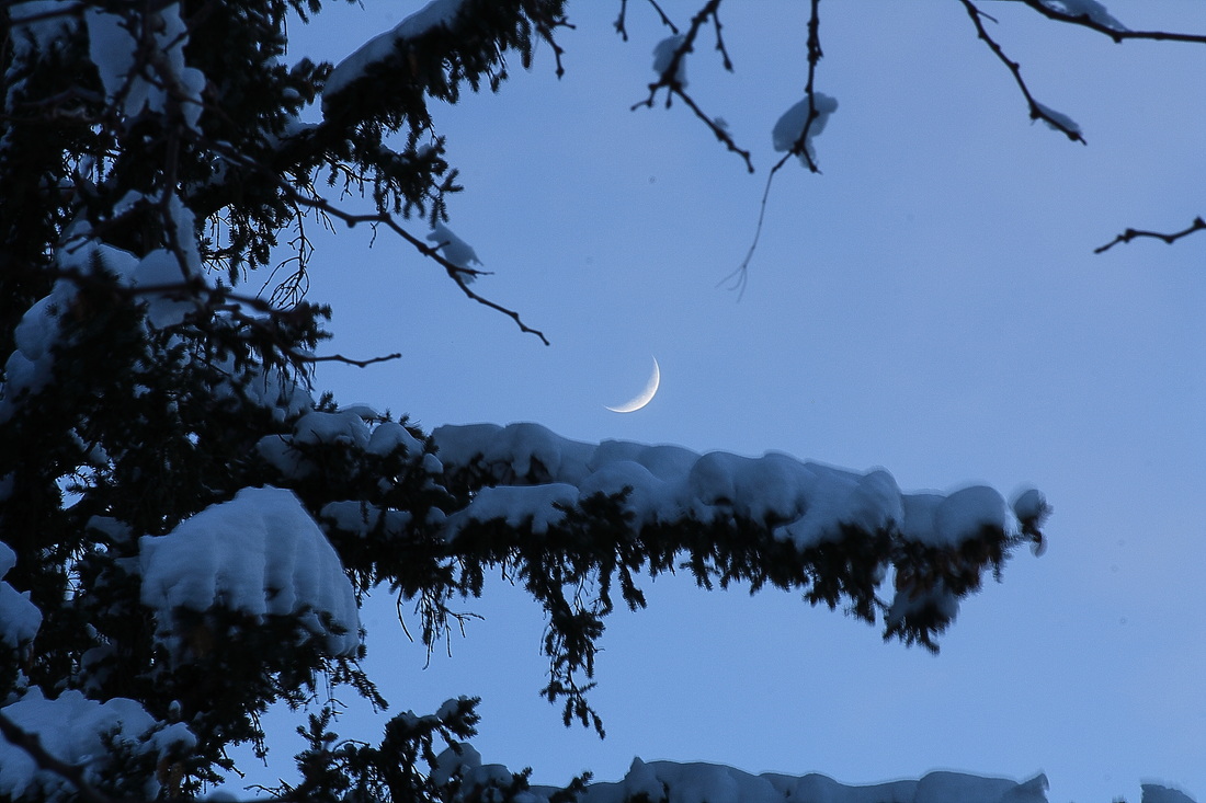
In the wake of the storm, even more beauty emerged. The clear blue skies contrasted against the white snow made the landscape come alive, giving all of us here in Flagstaff a new take on familiar scenery. Well, that's all for now, folks. Until next time, happy adventures,
0 Comments
Everyone in town has been baffled - how have we not had a true snow yet? Sure, we got one little dusting, but the lack of precipitation has the locals worried. Without the moisture, the national forests are in major danger and run the risk of being closed to recreational activities, making the issue especially important to the nature-lovers in Flagstaff (there are a few of them out here). Well, we finally got the first real snow on Friday of five inches or so, and the snow continued to dump another seven inches or so overnight and into the day. It made for a TOTAL winter wonderland on Saturday, so Felipe and I decided to go on a little adventure down the 89A towards Sedona. We packed up our gear and set off. We wanted to take the opportunity to witness some of the effects of elevation on snow accumulation, and to see if we could catch a few glimpses of red rocks covered in snow. Near Flagstaff, the snow continued to pile up. By the Overlook at the top of the Mogollon Rim it was knee-deep, so Felipe and I took turns sprinting through the fresh powder. The snow on the Overlook itself provided a fantastic case study in ecology. Because different types of trees (mainly Ponderosa Pine vs. Douglas Fir around here) hold snow differently, the snow allowed us to spot different tree types from quite far away. Douglas Firs tend to hold more snow on them, and they have a much more conical shape. Ponderosas, however, do not hold as much snow and they retain their green hue and round shape. From our vantage point at the Overlook, we could clearly see that the south-facing slope (which gets more sun) was totally dominated by Ponderosa Pines. The north-facing slope, on the other hand, was covered in Douglas Fir trees, with a few Ponderosas visible just before the rim of the canyon. Can you tell which way I was facing when I took this picture? In Oak Creek Canyon, we encountered an even steadier storm - except that this time snow was falling upon the famous red rocks. It was an unbelievable sight that, to me, conveyed the power of a storm to transform a landscape. As we reached Sedona Proper, the storm began to break. We watched as clear skies began to appear to the South, and as the dark storm clouds continued North, rising upwards onto the rim. ... And then it was gone. The storm left behind only fleeting memories of its presence on the desert flora, and hope in the hearts of a couple young men that more storms are to come.
My bike is a part of me. I have said this for a long time, and after riding it as my exclusive form of transportation over the past year and a half, I believe it more than ever. Nothing confirms this belief like a good snow. I woke up on Friday morning and opened my window to a beautiful scene: pure white snow covering the landscape outside my window. The streets were unplowed, the sidewalks unshoveled, and the pine tree outside my window held all of the snow up perfectly, offering it to me like a little child: "Look! It snowed last night!"
We had a two-hour delay at school, so I took a lot of extra time to cook and enjoy the scenery. Of course, I also had to switch out my tires for something a little more snow-appropriate. When it was time to go, I threw on my gear and headed out into the storm. At first, the going was a bit sketchy. Every bump of ice underneath the snow worried me, and every time one of my tires slid or spun out I stopped completely to put a foot down and steady myself. I felt much the same way as I do when I walk on snow or ice for the first time. After a day of riding, though, I could feel my balance coming back to me. Every time my tires slipped instead of over-correcting and stopping, I continued to press the pedals and regain balance. I flew over deep snow instead of getting stuck in it. It took a day of slipping, but I have once again have my wheels under me again. "The Canyon giveth, the Canyon taketh away" Just two days after visiting Glen Canyon Dam to watch the beginning of the High Water Flow experiment, Peter, John, Ana, Scott, Jason, Jeff, and I loaded up our weekpacks and started off down the New Hance Trail into the Grandest of Canyons. Google the New Hance trail and I am sure you will get a bunch of rants about how it is the most absurd thing that ever existed, or at least the most absurd thing that is actually called a 'trail'. My own conviction on the matter is that you aren't hiking unless there is a bit of class 4 involved (you are just strolling). Needless to say, I thoroughly enjoyed the decent into Red Canyon, which weaves and winds down through the Kaibab and Toroweap limestones, the Coconino sandstone, the Hermit shale, the Supai supergroup, the Redwall limestone, the Muav limestone, the Bright Angel Shale, and the Tapeats sandstone. The trail ends by Hance Rapid on the Colorado River after culminating in some AMAZING dry-creek hiking through the bottom of Red Canyon (which I accidentally called Hance Canyon in this video). I LOVE boulder-hopping and downclimbing the grand and colorful boulders of that place. While I was there, I ran a few experiments on the local hydrology. With the High Flow Experiment still in operation, the river level was WAY HIGH. Trees, trails, and the famous invasive plant called the Tamarix were all underwater, which made for very interesting hiking (or should I say climbing) the next day, and also forced us up onto a high beach to camp for the night. We ended up in a righteous campsite tucked underneath a maze of twisting tree branches that made for a great kitchen/closet/living room. Immediately upon arriving at camp, Springs basically curled up and started napping. I told him that was a dumb idea because he missed an AWESOME view of the moon coming out. He wasn't much help in the morning either - he pretty much climbed up in a tree and watched me pack and do all the work. As I have alluded to previously, the Canyon was formed by a number of geological processes. The first was the original deposition along the sea floor of sand, mud, and the skeletons of ocean-dwelling invertebrates. Over time, these materials were buried and 'lithified' (turned into rock) under high pressures. The land then rose (it was 'uplifted'), allowing for the development of a river which then downcut through what is now the Grand Canyon. Finally, erosion also occurs on the edges of the Canyon, constantly whittling away at the sides of the giant hole in the ground. The result is a number of interesting rock types and structures. You may see the 700 million year old ripple marks now frozen in time. Shale layers may flake off one at a time, each representing a number of years beyond the human ability to comprehend. Sandstones may show interesting layers also, which could be a clue as to a different environment at the time of deposition - though bends and curves in these layers may have formed while the sand was being lithified, far under the ground and under high pressures and temperatures. It is the challenging job of scientists to interpret all of these clues as to what the past was like, and they use a stunning number of ingenious techniques to understand and interpret the different processes that make these rocks into what we see today. Rocks aren't the only interesting science to be found in the Canyon. The harsh desert environment makes living a struggle for any type of life, and the adaptations that plants and animals make in order to adapt and thrive are nothing short of astonishing. Some of my favorite plants are the cacti, which in order to adapt to the lack of water have lost true leaves, which are a characteristic trait of many plant species throughout the world. Instead, the cactus retains only spines, which serve many purposes including water retention. To me, the most amazing trait of cacti in the Grand Canyon is the massive diversity of the plants - there are all different types in different locations; if Darwin would have visited this place he would have never had to wait to publish his theories! It would have been just too obvious. On Thanksgiving Day we made our way across Papago Creek, which is certainly another one of my happy places. I took the time to drop my pack and explore the creek for a while. At the mouth of the dry creek, there was another canyon slide that was too intense for me to do, because in the world's biggest playground it's a long way from help if you are stupid and hurt yourself. Again, the Canyon givith (to those who are respectful), and the Canyon taketh away (from those who aren't). I climbed back out of the creek and walked around to get a good feel of just how big it was from the front also. It was a very nice drop. After Papago Creek comes a bit of a traverse across cliffs above the river, followed by a hike up the beginning of 75-mile canyon. The high canyon walls make the place feel like home. The exit out of the canyon includes a great bit of full-pack, low-grade 5th class climbing. Super fun. On Thanksgiving night, we enjoyed another great moon. Oh yeah, and a TON of Thanksgiving food - turkey, stuffing with butter, green beans, cranberries, and even pumpkin pie, whipped cream, and eggnog! We cooked it over good old homemade alcohol stoves made from old beer cans, of course. A few Grand Canyon hikers happened to be at the same beach as us, so we invited them down for the festivities. One father was hiking with his middle school aged daughter, so they were especially timid to come down and celebrate the holiday with a bunch of eggnog- and bourbon-drinking crazy hikers. But, the smell of pumpkin pie rapidly melted their timidness, and all of us agreed we had never seen such a happy 14-year-old after she had 3 pieces of pie. Later on I played with taking some night pictures in my eggnog-induced stupor. We awoke, feeling fresh and ready to go... kind of. :) We hiked to Cardenas Beach, where we camped for the night. Throughout the time we were there, water levels were still dropping, and by the morning we were able to see some really impressive results of the HFE - beaches had built up to impressive levels. We started our ascent to the top of the Redwall along the Tanner Trail, being constantly rewarded with great vistas and cool views of century plants. As always, when it came time to leave, we just weren't ready to go. Though we had dreamed all week about the steaks and ice cream that we would eat at the end of the trip, they just didn't seem that appetizing anymore. Nonetheless, we packed our bags, hacked, and hiked out of the Grand Canyon. That's it for now, folks. Until next time, happy journeys.
"Education is like water flowing on rocks. The effects are hard to notice immediately, but years from now the results will be unmistakeable" On Monday, November 19th of 2012, my students and I witnessed a historic event and a ... concrete ... reminder of the power humans have to alter our environmental surroundings. It was the first High Flow Experiment of a new series of such experiments, and we were invited to attend the event through a series of pretty lucky connections. When I think of the Colorado River, I rarely ever say the name with out the adjective 'mighty' applied in front of it. The river simply seems so wild and so rugged - it is a symbol of the Wild West. But the sad truth of the matter is that the modern day Colorado River, as compared to its former grandeur, is a poodle in comparison to a wild wolf. The similarities are there and the form and shape is the same, but ... well... you get the point. Let's put it this way: the Colorado, in its natural state, had the erosive power to cut through a vertical mile of solid rocks and form the Grand Canyon over just 6 million years. Natives and explorers who saw and lived on the river in its natural state noticed the dark red color of the river (as evidenced by its name - Colorado meaning "Red" River) that was a result of the massive amounts of suspended sediment (aka chunks of broken rock chopped off from the surrounding walls by the fast flowing river). Ask anyone who has seen the Colorado River flowing through the Grand Canyon - it is a dark blue. That color isn't quite living up to the river's name... Why is the once-red river tinted blue? Well, the short answer is dams. These massive concrete structures - the most famous being Hoover Dam and Glen Canyon Dam - block all water in the river from flowing. The water backs up and creates a huge lake (called a reservoir) upstream from the dam. As you can imagine, water that is still cannot continue to carry sediment downriver. The sediment sinks to the bottom of the reservoir, and the water that is released from the dam continues on downstream clear, blue, and free of sediments. According to the Glen Canyon Institute, 100 million tons of sediment is piled up behind Glen Canyon Dam annually. That's 30,000 dumptruck loads of sediment every day. That means that Lake Powell (the reservoir created by Glen Canyon Dam) could fill up completely in just 300 years - a blink of time geologically. We will eventually have to tend to this concern, and as the Glen Canyon Institute notes, the longer we wait, the more expensive it will be. The water downstream of the dam isn't just sediment-free; it's cold. Whereas the river water's temperature should naturally fluctuate with the changing seasons, the water released from the dam comes from the bottom of Lake Powell where water never sees the sun. This perennially cold water exits the dam spillways all year round just above the freezing temperatures. Another major dam-induced change to the Colorado River is the absence of floods. Historically, springtime snowmelt and summer monsoons would cause fluctuating river levels that redistributed sediments and actually supported native fish species. Luckily, the dams along the river are capable of periodically releasing high amounts of water, which can simulate the conditions of a natural flood. This is the reason my students and I visited Glen Canyon Dam on the 19th - it was the dawn of a new protocol in High Flow Experiments (HFE's) on the Colorado River. HFE's have been conducted on the Colorado before - first in 1996, and then again in 2004 and 2008. As you notice, the events were spread out with several years between experiments. Furthermore, the experiments were run basically when the political and monetary concerns were worked out. Under the new protocol for HFE's, the timing of the flood events will be driven by science instead of policy. This means floods will occur when we know they should based on the environmental conditions, and they will be strategically timed with the 'sediment trigger' - a time when the river will be able to most effectively capture sediments and redistribute them for the benefit of native wildlife species and recreational river users. The event was certainly educational for us, and while we were there we got to meet the Secretary of the Interior, Ken Salazar. Even more impressive for me was meeting the Director of the National Park Service, Jon Jarvis, who was a totally down-to-earth person who LOVES his job - an inspiration! One of our students even got picked up by Secretary Salazar! We still haven't quite figured out why!
The American Gut Project is live! This project is part of the Human Food Project, and both are in line with the Human Microbiome Project.
These are projects devoted to understanding the relationship between human diets and the diversity and types of microorganism species found living in the guts of the humans eating those diets. It is fascinating stuff. Did you know that scientists can predict, with 90% accuracy, whether a person is obese or not based on the microorganisms living in their guts? Here is an awesome new article to read on the subject. Anyway, you can donate to the American Gut Project and receive a test kit which can allow you to compare your gut microbiome to those of other people around the US and the world. Check it out. Felipe and I joined Peter and Ana on a day-hike down the Tanner Trail last Saturday. We carried down eight and a half gallons of water, 18 beers, and a bottle of bourbon to stash a cache for our upcoming Thanksgiving hike. Oh give us a break - like you won't indulge yourself over Thanksgiving weekend! The white, puffy clouds warned of rain and dotted the landscape with shadows, but we never felt more than a few drops hit our skin and the shadowed landscape highlighted the beauty of the natural colors of the Canyon. I am trying to learn a bit more about photography and taking cool pictures. Today, I posed a challenge to myself... take all my pictures in black and white. The Canyon is a good place to do this because of the texture of the landscape... folds and cracks in the rocks and gnarled junipers can stand out even more in black and white than in color. So, my challenge was essentially to find texture in the landscape that out-shaded the brilliantly rusty colors of the Canyon and the clear blue of the Colorado River and the sky. The photography challenge was fun, but I mean it when I say you should have seen it in color. As I desired, on the dawn of the first snow I got up, ate lots of bacon, packed my gear, and headed off on a mini-tour down to Sedona. Makenzie was excited to have a new Fargo and joined me - company is always good on a tour. We set off in Flagstaff with the fresh snow on the mountain glimmering in dawn's early light. As the sun rose, the light powder on the ground began to melt quickly. We turned off onto Old Munds Highway - an old dirt road with log cabins, old farms, and a whole lot of character. After ten miles or so we turned off onto FS 700 - a forest service road full of nothing but gravel, pines, and old, shot-at T.V.'s and couches. We continued to gain in elevation, eventually hitting fairly deep melting snow - a major challenge for riding. We slipped, spun out, and balanced through deep pools to get to FS 240, where we finally began to descend a bit and caught a glimpse of the Mogollon Rim with blue skies beyond! We descended through the extremely righteous community of old wooden mansions and ski yurts at Munds Park, getting even colder by the second, and decided to skip a large portion of the forest roads for sake of getting to the Rim in a more timely manner... so we rode on Interstate-17 for about 3 miles before reaching Schnebly Hill Road, from where we hoped it would be all downhill... We continued down Schnebly Hill Road for a few miles and quickly realized we were not quite to the rim yet. In fact, the mud kept getting deeper and deeper. Finally, we got to the point that mud was getting stuck on my tires. The result was that the mud was getting jammed between the tire and the frame of the bicycle and subsequently freezing, rendering both tires and the crank of my bicycle virtually immovable. We stopped for several minutes chipping ice off of my bike and deciding what to do before a man in a truck drove by and told us that the snow line was just a ways down the road! I decided to carry my bike to get there! Just as we set back off again, me with my bike slung over my back, Makenzie's rear derailleur got caught in the rear spokes and snapped off of her bike. We couldn't do anything but laugh at this point. We decided that if I could carry my bike to the snow line, she could take the derailleur off and coast/run the rest of the way into Sedona - after all, we were supposed to be close to the Rim anyway! So, we did just that. Before we knew it, we hit the rim and could see red rocks in front of us... and a BIG downhill on the road ahead! Perfect! We began to coast... and coast... and coast! And the weather was clearing, it was getting warmer! We reached a beautiful overlook and were simply stunned by the landscape before us. After riding through snow all day, we were now surrounded by lush green trees and bright red rocks. Yet, just as swiftly as the warm weather had come on, a huge storm of snow appeared on the horizon and began to consume vast swaths of the red rocks and trees by the second. Within a matter of minutes the storm was upon us, and we were in the middle of a red rock blizzard. We booked it back on down the road (well, as fast as Makenzie could 'book it' with no chain or rear derailleur), and after about 20 minutes of descending, the storm cleared again. We made it into Sedona just as dusk was settling on the town. Believe it or not, we decided to call our friends for a ride back to Flagstaff the next day instead of camping and riding back with no chain/derailleur :)
(A continuation from Panama, Part I) The last night we were to spend on the Kuna Yala Islands proved to be quite enjoyable and eventful. A young Kuna who was planning on soon heading to the mainland to attend college lead us around the thin, dirt alleyways of Carti. After the lone authority on the island, a scowling military policeman, tracked us down to check our passports, we got a full tour of the island in about a half hour. We passed the school, the hospital, the church, and many a hammock-strewn front porch. We ended in a large common space inhabited by about 10 young Kuna men who were having a grand old time with several packs of Balboa, one of Panama's prided beers. They welcomed us in - overwhelmed to have visitors to entertain - and supplied us with Balboas. Before we knew it, they were teaching us Kuna, and we were teaching them English, all through the common language of Spanish. It was pretty darn cool. By the end of the night, we were making jokes and laughing like crazy, which was when I really felt like my Spanish was on-point. It felt good. The next morning we woke up on the islands in the Atlantic Ocean, planning to be on the Pacific Coast once again in just a few hours. We had our traditional Kuna breakfast - Kuna bread was served accompanied with peanut butter and nutella. We had a bit of a treat though - leftover lobster from last night, and eggs. You know I was all over that. We boarded the boat for the last time and headed to the mainland, where we hired a driver from Panama City to take us back to la Ciudad. He proceeded to step on it and drive back up over the steep mountains in his old, manual transmission Land Rover at 110 km/h while texting and passing other vehicles on the skinny, twisty dirt road. I tried to ignore the my gut reaction, which was telling me to either scream or throw up, and instead to enjoy the total beauty of the landscape. After cresting the last ridge among the peaks, we could see the City through the blue of the horizon. We made it back to Panama City, found a supermercado, stocked up on some supplies, and while some of the group sat down to eat, Mikey and I went off to find out if we could catch a bus west. We spoke with a man in a ticket booth in the main bus station, and all of a sudden we were being rushed off to a bus - the crew that was eating chasing after Mikey and me lest we get split apart in a place where we had no access to cell phones and a general sense of direction. Our bags were thrown atop the roof of a nice looking white minivan/bus. After travelling on the Diablos Rojos, we were excited to have a respectable bus to travel on to our next destination. Then, the doors opened.... People almost spilled out of the bus due to overcrowding. Nonetheless, we were ushered onto the bus, squeezing in between the seats and next to the driver, and off we went. Little did we know that this experience would parallel our experiences throughout the rest of Panama, and that Panama has a bus system that FAR, FAR exceeds the utility and ease of the U.S. bus systems. Almost literally the entire country can be accessed via bus in a reasonable amount of time (it helps that the country is only about the size of South Carolina). All one needs to do to get to the next town is to stop on a roadside, and a bus will stop (no matter where you are) within a few minutes to pick you up. If the bus is not going where you desire, they will give you instructions for which bus to catch to get there. The man who had thrown our bags on top of the bus was the bus helper - one of them rode on every bus and collected the money so that the driver did not have to worry about it. It makes the system very easy, and bus fares were usually in the range of a few quarters. We crossed La Puenta de las Americas and after about an hour of driving, the driver told us we were at Campana. There was a slight misunderstanding, as we had wanted to go to Altos de Campana - a not-so-popular mountainous national park - instead of to the town of Campana. I don't think a whole bunch of people understood that we actually wanted to go to some of the highest, most remote spots in the country for enjoyment. Anyway, we determined that we were "only 15 km" from Altos de Campana (a distance that Mikey seems to think is like a stroll in the park, probably since she can cover the entire thing at a 6 minute mile pace without blinking an eye). So - what did we do? Started hiking along the Interamericana - the highway that runs from Panama City to Mexico and is actually a part of the larger Pan-American highway, which runs from Prudhoe Bay, AK (another place that I have been!) to Ushuaia, Argentina. We were honked at the ENTIRE time as we hiked - we came to find out that this was simply what Panamanians do to say "Hey, do you want a ride?" Eventually, we reached our turnoff and started up a WICKEDLY steep ascent! I mean, damn! I think even Mikey broke a sweat! (did I mention Panama is hot in the summer? Like... REALLY hot) Luckily, a few minutes later, we were being honked at... a bus was headed up to Altos de Campana! They picked us up, gratis, and we climbed and climbed up a twisting road through what I can only describe as 'The Land Before Time.' We arrived at the ANAM Ranger Station, where the main park ranger and his intern sidekick gave us directions to a good campsite. We hiked up the road for a bit and turned off onto a red clay path, only to be caught by the intern. He seemed to think we would get lost, so he had come to lead us to the site. Indeed, we would have gotten lost, as the path was not as simple as they had made it seem, and it was growing darker by the minute. We eventually made it to our campsite, thanked the intern for catching us, and started to set up camp and strip off our clothes that were totally soaked in sweat in favor of something drier that we could sleep in. (little did we know that we would be sweating profusely even while sleeping in the Panama heat. We made a meal ... the first of many of it's kind. White rice, lentils, cans of tuna, and chocolate. mmmmm In the morning, we got up, determined to hike long distances. And hike we did. We followed an intense clay jungle trail up and up until we reached the top of some peak from which we could see.... well... nothing but jungle. We were still covered by the thick trees and leaves. There were a heck of a lot of interesting and cool plants to check out, though. After hiking for most of the day and not finding the trail that we hoped would take us from the park to another town - El Valle de Anton - in 3 or 4 days of good hiking, we decided to just try to take a bus to the little mountain town. We hiked the road back into a tiny town called Chico, on the way finding a few good vistas that we could actually get a view from. We chatted with an old lady who owned and worked at a cafe until the bus came by and picked us up, and like a whirlwind we were off again. Wow... Best... Study... Ever. I think correlation definitely equates to causation here. Check out Paul's comments on the study at: http://perfecthealthdiet.com/2012/11/chocolate-what-is-the-optimal-dose/ SO anyway, I have been trying to get my last few Flagstaff rides in because it is supposed to snow this weekend! AH! Anyway, it has been beautiful - check it out: A few weekends ago we also had a cross race in Flagstaff! Awesome - since I LOVE cross! The videos should tell it all... I also need to post about my fall tour that I did when the Aspen's were changing. But I am too intent on getting outside right now. That post will come on some snowy winter's eve when I am writing by candlelight.
I think I will also go on a tour in the first snow this weekend :) |
Authormarshall moose moore is a meandering biogeochemist (a type of environmental scientist who studies elemental cycles) who is always on the lookout for good stories. The blog is a place to tell some of those fun stories. Check out The Course or The Brave Monkeys Speak Podcast for lessons and actionable goals to apply to YOUR life. The Life-Adventurer's Manifesto:
Categories
All
Popular Pages:
|